Duxbury

No watering needed

Round and Round” (glass smalti mosaic), by Boston-based artist Lisa Houck, in her show “Botanical Explorations: Mosaics and Paintings,’’ at the Art Complex Museum, Duxbury, Mass.

— Photo courtesy artist.

The museum says she creates "vibrant, imaginative images filled with color and pattern," capturing the shapes of the natural world using found and created ceramic tiles.

After awakening from a trance

“Free Association” (Encaustiflex, wax, silver pigment), by Bristol, R.I.- based Leila Stokes Weinstein

She explains:

“My process is a combination of working on an idea that I want to express or just playing with materials, allowing my subconscious to make the decisions.The later is fun because suddenly I ‘awaken’ from a sort of trance or meditation, a place of no thought, to find something pleasing has been created.

''The three-dimensional capability of wax calls to me, whether it is a buildup of layers on a panel or embedded objects in a sculptural piece.

"Like most of the world, I am very concerned about the degradation of our planet and the rapid extinction of wild plants and animals, so my work often reflects on that and the beauty of nature around us.

"My work usually incorporates visual movement. The flow of water, the lapping of waves and the blur between land, water and air call to me.’’

Her bio:

Lelia Stokes Weinstein was raised as a Quaker. She was taught that there was good in everyone. In her art she explores joy, hope and peace. As a small child she loved to do art and was allowed to go to art classes in Cambridge at the age of 9. The experience of commuting for 2 hours by herself from the World’s End section of Hingham, Mass., helped further develop an independent and adventurous spirit.

She went to Friends World College, which required study abroad in at least two countries. Living in India and traveling overland to England through Afghanistan, Iran and Turkey she discovered the vibrancy of these cultures and how they embraced color and texture.

A misty morning in the Hingham, Mass., peninsula called World’s End

The front of the 231st Bristol, R.I., Fourth of July Parade in 2016.

— Photo by Kenneth C. Zirkel

A great artist paints craftsmen on the Maine Coast

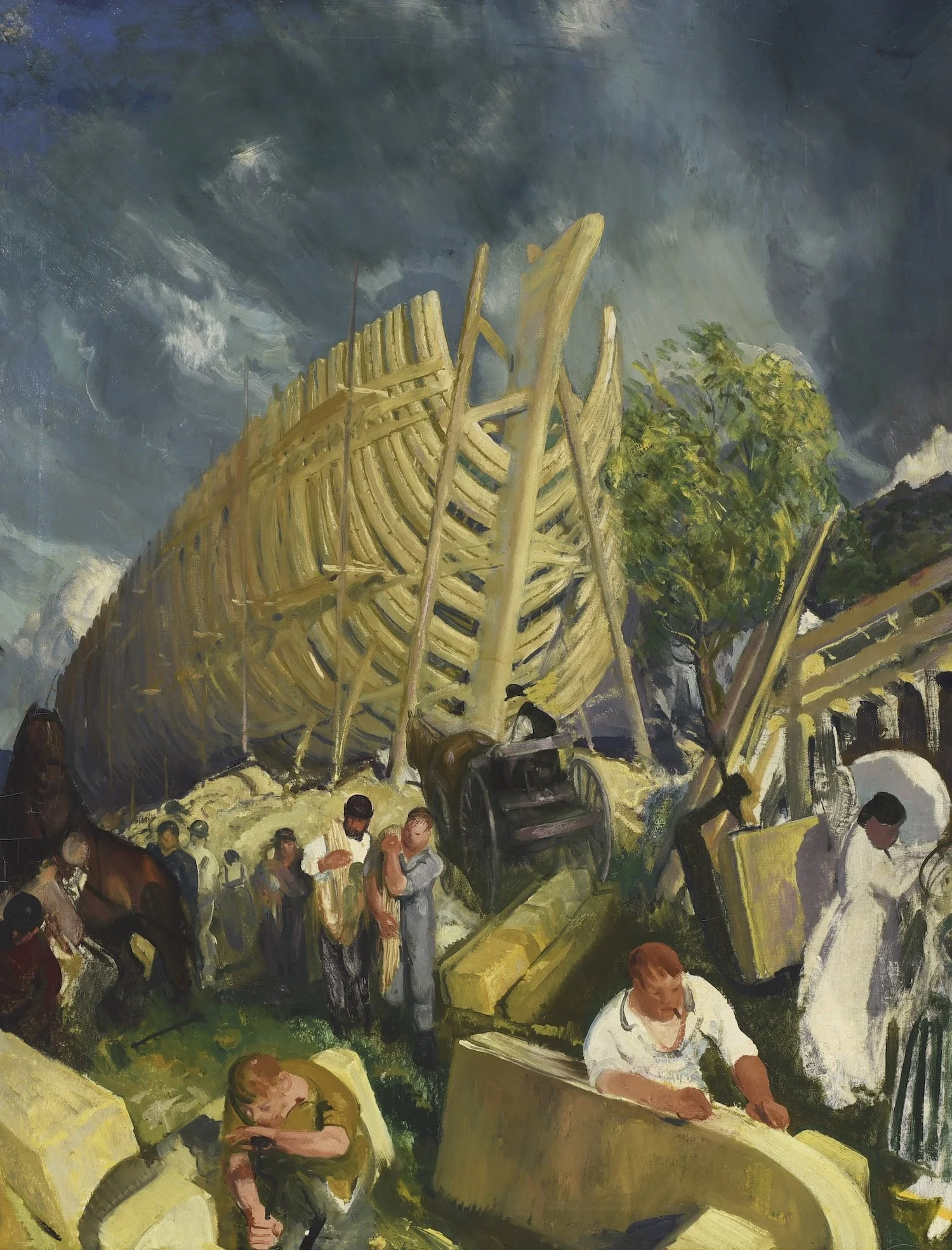
“Shipyard,’’ painted in 1916 by George Bellows (American, 1882-1925). It can be seen at the Art Complex Museum, Duxbury, Mass.

The museum says:


'‘The museum's permanent collection contains multiple works by American artist George Bellows. Bellows spent a few summers on the coast of Maine and its offshore islands in the early 1910s. The shipyard in Camden particularly drew his attention, and he created a series of paintings based on his time there, including Shipyard’’’.

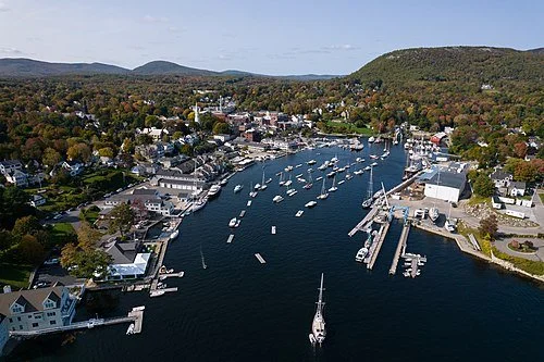
Camden Harbor. Camden and the Maine Coast in general have a long and famous tradition of boat/shipbuilding, though Camden has long been best known as a summer place for rich Northeast Corridor people (especially old-money WASPS) and others, many of them with fancy boats that they cruise and race in.

Or a mushroom cloud

“The Tree” (etching), by Marguerite Thompson Zorach (American, 1887-1968), at the Art Complex Museum, Duxbury, Mass. For a while a Californian, she later lived in New York City and in her family’s summer house in Georgetown, Maine.

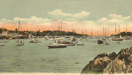
Five Islands, Georgetown, Maine, from a circa. 1906 postcard published by G. W. Morris.

The museum says:
"Marguerite Thompson Zorach is best known for her early modernist paintings and late embroidery creations. One of the first women to be admitted to Stanford University, in 1908, she was invited to study in Paris by her aunt, which changed the course of her career. There she met Pablo Picasso (1881-1973) and Gertrude Stein (1874-1946). She attended the avant-garde school La Palette, where she met her future husband, artist William Zorach. During this time, she created etchings like this delicate rendering entitled “The Tree,’’ thought to be an olive tree with olive pickers resting nearby.’’
To read more please click here.

Have a seat but bring your own cushions

“Bent Bench(black locust, concrete and stainless steel), by Mitch Ryerson, at the Art Complex Museum, Duxbury, Mass.

The museum explains:


”As part of our 50th anniversary celebration {this year} we held a call for artists for outdoor seating. Mitch Ryerson was one of five artists we chose to create benches to be placed in our newly landscaped woodland path. Mitch is an artist, designer and craftsperson specializing in wood structures and furniture. He began his career building wooden boats in Maine.’’

'Dip one's toes in'

“Poseidon’s Pocket” (collagraph),  by Massachusetts artist Vivian Berman (1928-2016), at the Art Complex Museum, Duxbury, Mass.The museum says:“Berman used silk scraps, aluminum foil, and matte acrylic medium to create a variety of textures within the single image. The print conveys such an authentic impression of the sea, one is tempted to dip one’s toes in! The artist’s abstract renderings of the sea, sky, and landscape often conveyed a sense of solitude. …. Berman was among a small group of artists who studied with Donald Stoltenberg (1927-2016), a printmaker who explored collagraph methods in the late 1960s. These artists advanced the medium and helped it to gain recognition as a fine-art form.’’

“Poseidon’s Pocket” (collagraph), by Massachusetts artist Vivian Berman (1928-2016), at the Art Complex Museum, Duxbury, Mass.

The museum says:

“Berman used silk scraps, aluminum foil, and matte acrylic medium to create a variety of textures within the single image. The print conveys such an authentic impression of the sea, one is tempted to dip one’s toes in! The artist’s abstract renderings of the sea, sky, and landscape often conveyed a sense of solitude.
….
Berman was among a small group of artists who studied with Donald Stoltenberg (1927-2016), a printmaker who explored collagraph methods in the late 1960s. These artists advanced the medium and helped it to gain recognition as a fine-art form.’’

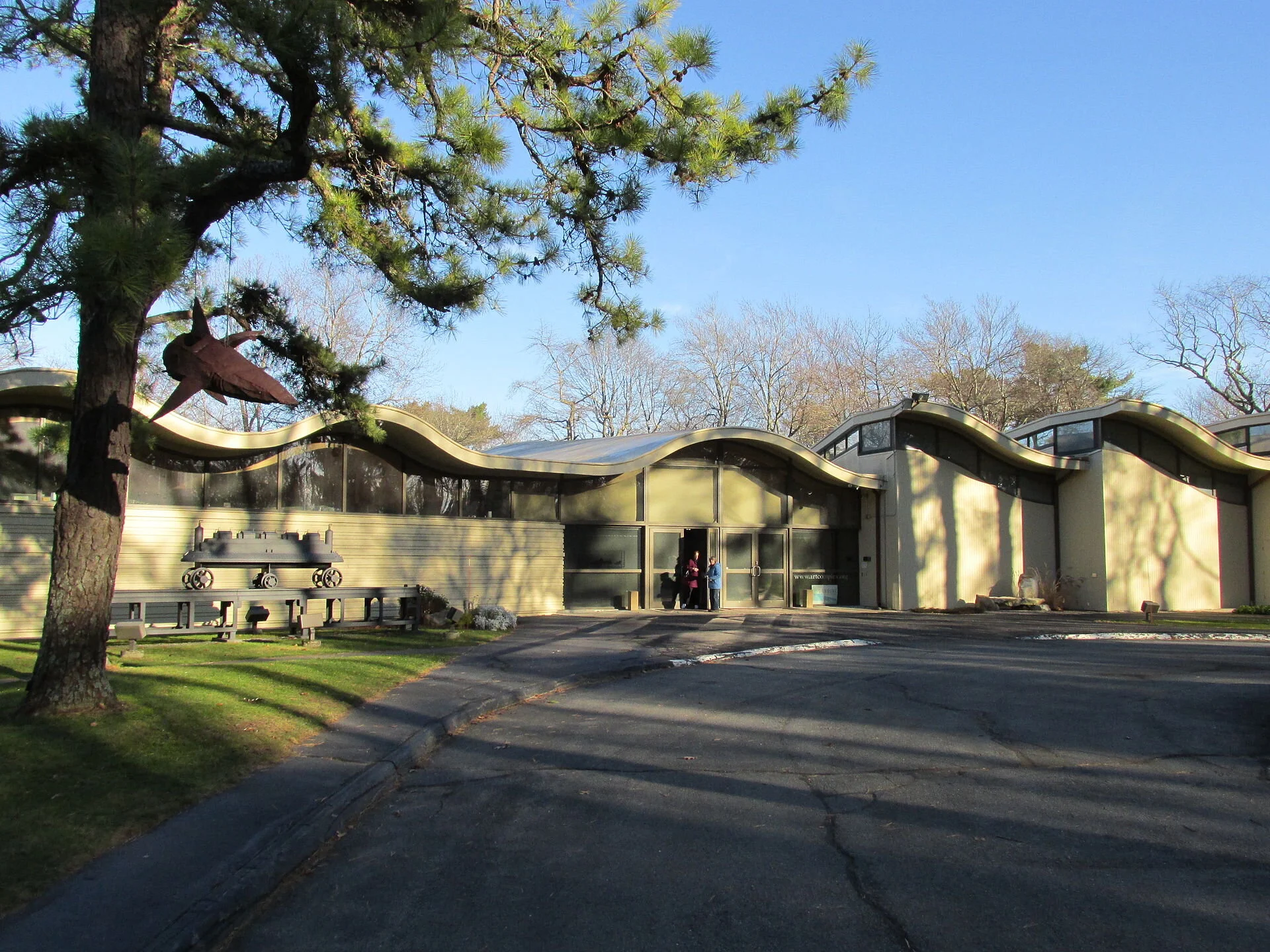
The Art Complex Museum

The Art Complex Museum

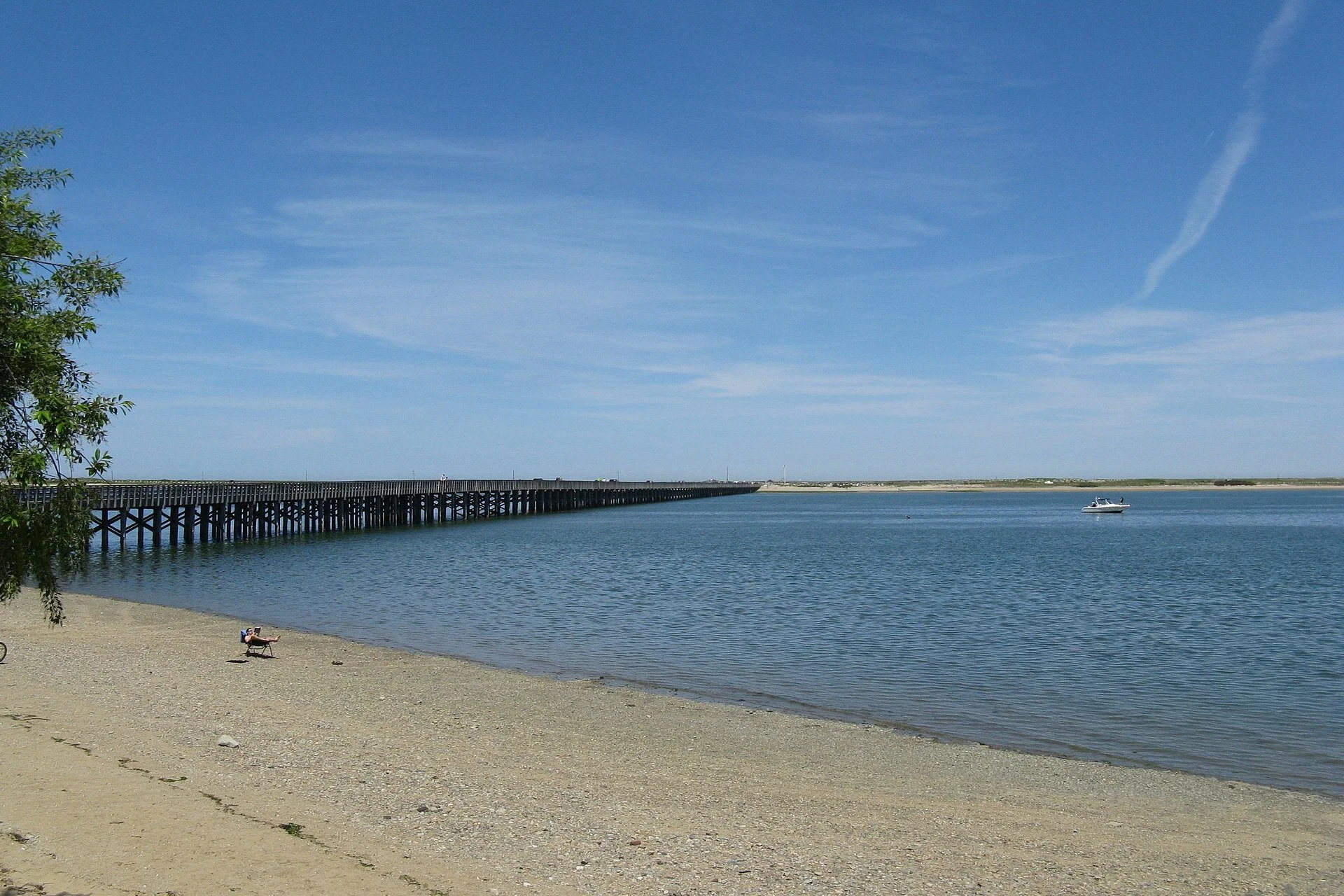
Powder Point Bridge, in very sandy Duxbury— Photo by John Phelan -

Powder Point Bridge, in very sandy Duxbury

— Photo by John Phelan -

Tough like the Blue Jay

From the Art Complex Museum, in Duxbury, Mass.:“In 2019, on the grounds of The Art Complex Museum, Donna Dodson and Andy Moerlein installed ‘Seeking Higher Ground.’ This is the second outdoor sculpture that the museum has been lucky to display. Acco…

From the Art Complex Museum, in Duxbury, Mass.:

“In 2019, on the grounds of The Art Complex Museum, Donna Dodson and Andy Moerlein installed ‘Seeking Higher Ground.’ This is the second outdoor sculpture that the museum has been lucky to display. According to folklore, the Blue Jay is symbolic of clarity of thought and taking action. ‘Seeking Higher Ground’ is a clarion call to heed the warning signs of climate change. It reflects a hope that humans can unite to affect those changes needed to adapt and survive - like the Blue Jay.’’

“To see more of their work and to watch a short video they have created please

click here.

'They would believe the lie'

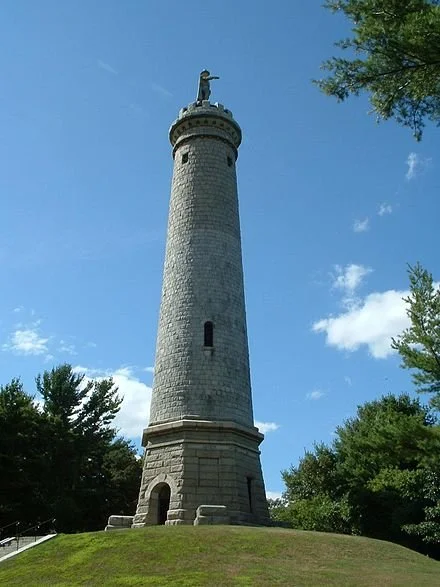
The Myles Standish Burial Ground, in Duxbury, Mass. It’s the final resting place (between the cannons) of several well-known Pilgrims who arrived on the Mayflower in 1620, including Captain Myles Standish, and was the location of Duxbury's first mee…

The Myles Standish Burial Ground, in Duxbury, Mass. It’s the final resting place (between the cannons) of several well-known Pilgrims who arrived on the Mayflower in 1620, including Captain Myles Standish, and was the location of Duxbury's first meeting house. It was in use from about 1638 until 1789, at which point the cemetery was abandoned. It was reclaimed in 1887 by the Duxbury Rural Society.

Colonial-era graves in Pemaquid Cemetery, Maine.Photo by DrStew82

Colonial-era graves in Pemaquid Cemetery, Maine.

Photo by DrStew82

The living come with grassy tread
To read the gravestones on the hill;
The graveyard draws the living still,
But never anymore the dead.

The verses in it say and say:
“The ones who living come today
To read the stones and go away
Tomorrow dead will come to stay.”

So sure of death the marbles rhyme,
Yet can’t help marking all the time
How no one dead will seem to come.
What is it men are shrinking from?

It would be easy to be clever
And tell the stones: Men hate to die
And have stopped dying now forever.
I think they would believe the lie.

“In a Disused Graveyard, by Robert Frost

Night work

“The Music Pavilion at Versailles, Moonlight“ (oil on canvas), by Henri Eugene Le Sidaner, in the show “Highlights from the Permanent Collection: Nocturne ,’’ at the Art Complex Museum, Duxbury, Mass., through Jan. 12.  The museum says that "Nocturn…

“The Music Pavilion at Versailles, Moonlight“ (oil on canvas), by Henri Eugene Le Sidaner, in the show “Highlights from the Permanent Collection: Nocturne ,’’ at the Art Complex Museum, Duxbury, Mass., through Jan. 12.

The museum says that "Nocturne paintings" were “originally defined as those that depict scenes evocative of the night, or portray subjects in a veil of light or at twilight. Nowadays, the term tends to refer to any paintings of nighttime scenes. Nocturne paintings are moody and alluring, capturing the unique tranquility that nighttime brings. Nocturne features works by a variety of artists across different countries and times.’’

The weight of history in 'Manchester-by-the-Sea'

The Old Burial Ground in Manchester-by-the-Sea, Mass. (Photo by John Phelan)

The Old Burial Ground in Manchester-by-the-Sea, Mass. (Photo by John Phelan)

Adapted from Robert Whitcomb’s “Digital Diary’’ in GoLocal24.com

Some readers may have seen the recently released movie Manchester-by-the-Sea, a devastating family tragedy, but with comic moments, too, and all suffused with a haunting New England atmosphere. I have seen few movies that present a sharper view of the often bleak beauty of New England’s coast and towns or of the anxieties and occasional joys of America’s lower-middle class, New England sub-species.

The film is mostly set in the eponymous Massachusetts town on Greater Boston’s North Shore. 

While the official name is the same as in the movie, when I was growing up in Cohasset, across Massachusetts Bay from the town, we only called it “Manchester.’’ I mostly remember the capacious gray-shingled summer places along the town’s rocky headlands and the big Federal Style and Greek Revival houses inland a bit. \

Many of the grandest places in Greater Boston are on the North Shore. That’s where a lot of Boston Brahmins repaired to in the summer; some moved there year-round after they winterized their summer places (when they weren’t in Aiken, S.C., Palm Beach, etc., in the winter). Perhaps because the North Shore ports of Salem and Newburyport had many of the China Trade types who became Boston’s aristocracy, it denizens tended to look down on the South Shore, although Cohasset and Duxbury had/have certain old-money pretensions.  So there were social links between the two shores, such as annual sailsbetween the Cohasset and Manchester Yacht Clubs. But someone from Cohasset approaching the shore of Manchester quickly knows he/she is entering more-monied waters than those back home .

The South Shore’s mostly sandy and shallow harbors, as opposed to the deeper rock-rimmed ones north of Boston, made  them unattractive for ocean-going ships in the China Trade.  Instead, the local big money often came from the shoe business and such things as rope-making. Not as romantic as trading with China!


Manchester has economically struggling people too, and the movie is mostly about them. Like many, perhaps most  Americans now, they are downwardly mobile. Too many of them medicate their anxieties, which can move into despair, with booze, opiates and cocaine.


Thoreau wrote that “The mass of men lead lives of quiet desperation’’. The characters in Manchester-by-the Sea are not always quiet but they are usually stoical in their suffering from their own mistakes and others’ outrages inflicted on them. But they can still summon up some dark  comedy and savor the absurd.

As the movie’s characters walk or drive through Manchester and neighboring towns, you get a sense of the weight of the region’s long history and of the cheeriness of its sunny days alternating with the gloom of its cold, gray and mean winter days darkened by proximity to a hostile ocean. Toward the end of the movie, you even get a sense of the uplift from winter finally succumbing to spring, when the ground has thawed out enough to permit the burial of one of the movie’s characters.

The movie obliquely recalls the regional history that pressed in on Nathaniel Hawthorne (from Salem) in The House of Seven Gables and The Scarlet Letter and William Faulkner’s line “The past is never dead. It’s not even past.”  New England and the South have a heavy thing on common: the weight of the most complicated histories of any American region except, perhaps, New York City.

One thinks of Faulkner’s  novel Absalom, Absalom!  in which the Harvard roommate of the Mississippian Quentin Compson says: : “Tell about the South. What's it like there? What do they do there? Why do they live there? Why do they live at all?"  You might ask the same question in mid-winter of New Englanders.

In Manchester-by-the Sea, the pertinent past is mostly in the lifetime of the main characters but you can feel the pressure of earlier time, too. And the film might remind us that most of those we encounter have potent psychic pain we know nothing about. If we did, we might pay attention to the old line: “To understand all is to forgive all,’’ though empathy can sometimes be over-rated.


Frank Carini: Rising waters threaten region's cultural treasures

Rising sea levels and increased flooding are problems for communities and historic districts along the southern New England coast, which has some thinking of turning Boston into a city of canals, much like Amsterdam and Venice. (Urban Land Institute)
Welcome to Boston

(FRANK CARINI is editor of ecoRI News )

Sea-level rise, more frequent and intense storms, and the subsequent flooding being caused by these climate-change impacts are putting U.S. historic sites at risk. The Cambridge-based Union of Concerned Scientists (UCS) lists Boston’s historic districts among the country’s most endangered.

History-rich and waterlogged southern New England needs to develop a plan on how to adequately protect the region’s many cultural resources and historic buildings from a rising tide of sea and flood waters.

The May 2014 UCS report that lists Boston among the 30 most at-risk historic areas across the country notes that the city is one of several along the East Coast experiencing more frequent and severe coastal flooding and more intense storm surges.

“You can almost trace the history of the United States through these sites,” said Adam Markham, director of climate impacts at UCS and the report’s co-author. “The imminent risks to these sites and the artifacts they contain threaten to pull apart the quilt that tells the story of the nation’s heritage and history.”

The 84-page report claims rising waters are a threat to Boston’s historic Long Wharf and to Blackstone Block — a compact district of narrow, winding streets and alleys dating to the 17th century.

Ten of the 20 highest tides in Boston during the past hundred years have occurred in the past decade, according to the report. Since 1921, when such record keeping began, the city has experienced waves 3.5 feet taller than normal 20 times, and half of those instances have occurred in the past 10 years.

In fact, high tides along the East Coast are getting, well, higher, largely because sea levels are increasing. National Oceanic and Atmospheric Administration (NOAA) scientists have said these increases are the result of shifts in climate — the seas, on average, are 8 inches higher than a century ago. The result is the growing occurrence of flooding in coastal communities.

Had Sandy, the October 2012 superstorm that wreaked havoc on New York and New Jersey and damaged historic buildings and landscapes up and down the Mid-Atlantic coast, hit Boston about five hours earlier, at high tide, the damage to some of the city’s historic sites would have been severe.

The Blackstone Block of Colonial streets, for one, would have flooded, according to the Boston Harbor Association. An association report claims that nearly 7 percent of the city would have been flooded, with floodwaters reaching City Hall, had Sandy arrived earlier.

The additional destruction under this scenario would have significantly damaged Boston’s economy. Some 12 million tourists visit the city annually, generating about $8 billion for the local economy. Many visit to walk the Freedom Trail, browse Faneuil Hall, a U.S. National Historic Landmark, and dine in some of the country’s oldest restaurants.

In fact, the Organization for Economic Co-operation and Development ranks Boston the eighth-highest metropolitan area worldwide in expected economic losses, estimated at $237 million annually, on average, between now and 2050, because of coastal flooding.

Boston, however, is hardly the only seaside southern New England community with a fine collection of historic attractions. Rising tides also threaten historical properties in Fall River, New Bedford, Providence, Wickford Village in North Kingstown, R.I., and Groton, Conn., among other places.

Cultural resources — i.e., libraries, archives, historical societies, museums, city/town halls and historic farms— are an important part of southern New England’s unique heritage. Their significance also includes the literary works, rare collections, manuscripts, historical archives, municipal records and artifacts they hold.

The Massachusetts seaside towns of Duxbury, Marshfield and Scituate are rich in New England history, and they’re also prone to flooding because of rising tides and heavier storm surges. In fact, the three South Shore communities in the past 35 years are collectively responsible for nearly $80 million in FEMA Flood Insurance claims — nearly a quarter of the state’s total, according to a recent study.

From 1978 to 2013, the three towns received a total of $78.3 million in flood-related claims, as compared to the total of $337.8 million for all of Massachusetts.

These communities are particularly vulnerable to sea-level rise because of their extensive floodplains and estuaries that reach into inland areas. In addition, their densely populated shorelines are fronted by narrow and fragile coastal and barrier beaches that are exposed to high-energy surf from Massachusetts and Cape Cod bays.

They have all experienced extensive damage over the years from storm-related flooding, which is predicted to worsen in the years ahead.

The Brown Street Bridge and much of historic Wickford Village in North Kingstown, R.I., was inundated during Superstorm Sandy’s visit in 2012. (Coastal Resources Center at URI)

The Brown Street Bridge and much of historic Wickford Village in North Kingstown, R.I., was inundated during Superstorm Sandy’s visit in 2012. (Photo from Coastal Resources Center at University of Rhode Island.)

The threat of rising seas, worsening storm surges and more frequent downpours arguably concerns Wickford more than any other historic district in southern New England.This small village on the west side of Narragansett Bay features one of the largest collections of 18th-century dwellings in the Northeast. Most of the village's historic homes and buildings — the majority privately owned — remain largely intact upon their original foundations.But rising waters are beginning to routinely lap against many of these old structures. A mid-August tidal surge, for instance, flooded a parking lot across the way from Gardner’s Wharf Seafood, turning the popular local business into a harbor island.

Grover Fugate, executive director of Rhode Island’s Coastal Resources Management Council (CRMC), has warned that some projections show sea levels rising as much as 6 feet in the next 100 years. If that happens, he says much of Wickford Village would be lost.

A 6-foot rise would flood about 150 parcels of land in Wickford, as much as 5 percent of the town, according to a Rhode Island Sea Grant analysis. The value of the land that would be lost is some $80 million.

Wickford’s municipal parking lot already floods regularly at moon tides. During Sandy, the iconic village lost power, basements were flooded and septic systems overwhelmed. Street flooding turned some properties nearest Wickford Harbor into small islands.

With this historic village — regarded by many as the town’s heart and soul — so vulnerable to flooding, Rhode Island selected North Kingstown for a pilot project in a statewide effort to develop climate-change adaptation measures. One of the project’s first tasks was to map areas of North Kingstown vulnerable to sea-level rise and flooding and then identify priority at-risk infrastructure, buildings and assets in those areas.

It likely would take a massive engineering project to properly protect this harborside village. This prospect begs the same question municipal officials, historical societies and homeowners across southern New England are grappling with: “How do we protect our properties and these districts from climate change without sacrificing their cultural integrity?”

“How do we balance preserving the historical integrity of these homes and also get them out of the way?” Teresa Crean, a community planner and coastal management extension specialist with the Coastal Resources Center and Rhode Island Sea Grant, said during a “resiliency walk” she led along Wickford Harbor in October. “There’s little guidance currently that addresses how to deal with historic districts when it comes to climate change.”

Complex problem The complexities of coastal adaptation combined with little guidance from the federal government makes the problem of protecting historic districts from climate change all the more difficult.

To slow the rate of change and give archaeologists, historic preservationists and land managers more time to protect historic sites, carbon emissions must be reduced, according to last year’s UCS report. But even if we manage to reduce our carbon emissions, much of the change is already locked in, according to accepted science.

In Boston, where many properties are close to sea level and many areas were originally wetlands filled for development, the Harbor Association has suggested, among other things, that the city consider making room for the encroaching waters with canals and/or lagoons.

A 117-page study released in July 2013 entitled “Building Resilience in Boston: Best Practices for Climate Change Adaptation and Resilience for Existing Buildings” offers experts’ recommendations for property owners in preparing for emergencies related to climate change.

Many of the techniques that are available to protect properties and/or districts are costly and/or don’t mesh with historic-district rules. Elevating a home, for example, can cost upwards of $150,000, according to Crean. She noted that in The Point neighborhood of Newport, R.I., which has one of the highest concentrations of Colonial homes in the United States, some homeowners have elevated their property to get out of the flood zone.

“But then there’s the ongoing discussion on consistency and what historic district commissions will allow,” Crean said.

Across southern New England such discussions have already become heated. Like most issues related to climate change, it’s difficult for some to even admit there’s a problem. Add historic district to the equation, and the issue becomes even more complicated.

Two years ago, Newport banned wind turbines from most of the city. Local officials were particularly concerned about property owners erecting small turbines anywhere in the city’s historic neighborhoods.

That same City Council concern, however, didn’t transfer to the power lines that connect the old homes in these neighborhoods to utility poles, or to satellite-TV dishes.

Just like the debate, often heated, that surrounds what is allowed in these historic neighborhoods, the conversation about how to protect them from climate change will likely be even more contentious.

Among the issues that will likely be hotly debated will be septic systems. To see how divisive the issue of cesspool phaseout and connection to municipal sewer can be, look no further than Warwick, R.I.

Much of the public opposition there comes from homeowners who are concerned about cost. Others have said, incorrectly, that if a cesspool — which is nothing more than a perforated steel bucket buried in a shallow pit or a covered pit lined with unmortared brick or stone — is properly maintained it will last forever. Some opponents against having to connect to the city’s sewer system have called the idea a tax; others have called it extortion.

Similar opposition has been heard in other communities in the region, such as Portsmouth, R.I.

In North Kingstown, however, most of the town is scheduled to be sewered by 2017, but Wickford will not be, and property owners there will be required to upgrade failing septic systems, which are typically expensive projects.

“At what point do you allow properties to be occupied when you can’t flush a toilet?” Crean asked. “It’s another tough question we’re struggling with, to honor property rights and investments made and to protect public safety and health.”

There are homes in historic districts in Massachusetts, Rhode Island, such as Wickford, and Connecticut that can’t flush their toilets now after heavy rains, for fear of popping the caps off their inundated cesspools or septic tanks.

In fact, climate-change impacts will likely increase groundwater elevations in southern New England’s coastal areas, which could potentially impact underground infrastructure, such as septic tanks and cesspools, commonly found in historic districts.

Protecting the region’s historic properties from the rising waters of climate change will take planning, funding, compromise and sacrifice. It will be considerably more difficult than simply enacting a plastic shopping bag ban, and we’ve seen how punishing that endeavor has become.

Impacts to historical/cultural resources from climate change range from coastal erosion and storm damage to the effects of increased flooding, melting permafrost and more rapid deterioration because of changing rain and temperature patterns, according to the National Park Service.

To properly protect the country’s inventory of these resources, the federal agency has noted:

Cultural resources can’t be managed in isolation; natural resources and the surrounding landscape must be taken into account.

A national inventory and prioritization of vulnerable sites is needed to assess the uniqueness of these sites.

A time frame for adaptation strategies needs to established.

A resource in poor condition due to deferred maintenance or insufficient funding has a different kind of vulnerability.

There is no natural hierarchy or sequence for the criteria; they should be assessed as more of a matrix that will vary site to site.

To incorporate many of the possible solutions will likely require zoning changes and embracing best technologies. For instance, would municipal zoning and/or historic-district guidelines allow for the use of composting toilets? Would home owners be interested in installing them?

Also, utilities in most historic homes are in the basement and vulnerable to flooding. Where can they be moved to better withstand increased flooding that climate change is expected to cause?

Can solar panels and wind turbines be tastefully incorporated onto historic buildings? Will green roofs be allowed in historic districts?

“Zoning needs to catch up with new technologies and best practices,” Crean said. “But a lot of agencies aren’t even on the same page.”

As Crean noted during the October tour of Wickford Village, one thing is for sure, “The longer we wait to address this problem, the more expensive the solutions become.”

Both financially and culturally.

Chief Ricci's suicide and other Cianci regime history

 Hausrath
"Fragile Remains'' (collagraph and trace monotype print), by JOAN HAUSRATH, at the Art Complex Museum, Duxbury, Mass.
For new arrivals in Providence, and citizens with amnesia: Note  this excerpt of  an April 25, 2007 article by Bill Rodriguez in the Phoenix:
''Now that Buddy Cianci’s scheduled July 27 prison release date is approaching, Providence documentary filmmaker Cherry Arnold is getting around to a theatrical release of Buddy, following a successful victory lap on the film festival circuit....''

“'During the screenings outside of RI, in New York for instance, there were more gasps and audible reactions where people who didn’t know Buddy’s story were, I think, shocked by some of what happens, like the police chief [Robert E. Ricci] committing suicide [in 1978] and the assault details,' she notes. “'Outside of RI, lots of people ask during the Q&A why he was able to run for mayor again as a convicted felon. They’re very curious about that.”'

Then there are the sweetheart pension deals  and running City Hall as a criminal operation. But, hey!, nobody's perfect! The heavy price of statesmanship!

As H.L. Mencken's line goes:

''Democracy is the theory that the common people know what they want, and deserve to get it good and hard.''


Soothing to see if not smell

Haywood "Shimmer'' (pastel), by LIZ HAYWOOD-SULLIVAN, at the Art Complex Museum, in Duxbury, Mass.

New England's salt marshes are soothing to look at, if not necessarily to smell, especially in the summer.  In any cases they clean coastal waters and act as vast protein factories because of the fish and shellfish they nurture.