Charlestown

Magical materials

“Dreams of Spring,’’ by Pat McSweeney, in the show “Greater Than the Sum of Its Parts,’’ at Galatea Fine Art, Boston, through Aug. 27. The artist is based in the Charlestown section of Boston.

The gallery says the show features the work of fiber artists who "create new visions" by "reinventing old techniques." The artists use "fabric, thread, wool, reeds, paper, wire and even plastic to create magic.’’

Tangled up in empathy

Three Models Legs and Hands(watercolor,), by Donald C. Kelley, courtesy of The Artists Group of Charlestown (part of Boston). This is in the show “Donald C. Kelley: The Legacy Continues,’’ sponsored by The Artists Group of Charlestown, at the StoveFactory Gallery, Charlestown, through July 17.

Kelley (1928-2018) wrote in his artist statement: "Empathy lies at the heart of my figure drawings; I try to communicate directly through feeling ... when I am drawing or painting a representation of the body, I imagine myself within that body."

Site of Puritan leader/Boston founder John Winthrop's "Great House" in City Square, Charlestown, uncovered during the Big Dig. Archeologists said the building was occupied by Winthrop from July to October 1630. It was the Massachusetts Bay Colony's first government building, as well as Winthrop's dwelling before he moved to Boston.

‘There be dragons’

The Babcock House in Charlestown, built in the late 17th or early 18th Century.

—- Photo by JERRYE & ROY KLOTZ, M.D.

The town’s Quonochontaug section had an iron-mining operation financed by Thomas A. Edison in the 1880s. There were iron particles in the form of black sand on the beach there that could be separated out with magnets and melted to produce iron. But the venture collapsed after cheaper iron was later discovered.

Adapted from Robert Whitcomb’s “Digital Diary,’’ in GoLocal24.com

For such an amusingly tiny place, Rhode Island has intense localisms. Consider Kevin Gallup’s remarks. He’s a former police officer and now director of the Emergency Management Agency in Charlestown, in the exurban south of the state.

Mr. Gallup ominously warned, in comments about PVD Food Truck Events coming to Charlestown, that “things morph’’ and town residents “might not appreciate” having people from Providence come to town for events.

“If we’re going to have people showing up from Providence and hanging out that we don’t know…along with our children…some people aren’t going to appreciate that and I can tell you that for a fact. So you’re going to need that police detail. Sorry the world needs to be this way, but these things need to be thought out.”

There’s a long tradition of seeing cities as a source of menace, including in a “city state’’ such as Rhode Island.  Do Charlestown people feel safer with visitors from smaller city New London, Conn., 34 miles from Charlestown,  than with people from Providence, 48 miles away? 

Remember those old maps that had the Latin phrase “hic sunt dracones” (“there be dragons”) for dangerous and/or unexplored regions? One wonders how familiar Charlestown people are with the capital of their state, and how many would say they’re all too familiar with it. People can be very provincial around here, and I’ll bet plenty of people from South County have never been to Providence.

Quonochontaug Pond.


‘Complacent in her captivity’

“Emily’’ (mixed media), by Joe Caruso, in Galatea Fine Art’s (Boston) online gallery.This text runs with it:“She stares out of a prison of an unknown making, complacent in her captivity. The woman's image in this construction seems unaware that time…

“Emily’’ (mixed media), by Joe Caruso, in Galatea Fine Art’s (Boston) online gallery.

This text runs with it:

“She stares out of a prison of an unknown making, complacent in her captivity. The woman's image in this construction seems unaware that time is passing. Once she was young and the world was open. Now she guards hidden memories.’’

Mr. Caruso lives in the Charlestown section of Boston, though his studio is in South Boston. Charlestown is the oldest part of Boston, having been originally laid out in 1629.

See:

joe-caruso-jwkc.squarespace.com

And:

galateafineart.com

1629 site of the "Great House" of Puritan leader and the Massachusetts Bay Colony’s leading founder, John Winthrop (1587-1649) in City Square, Charlestown, uncovered during the Big Dig

1629 site of the "Great House" of Puritan leader and the Massachusetts Bay Colony’s leading founder, John Winthrop (1587-1649) in City Square, Charlestown, uncovered during the Big Dig

The Bunker Hill Monument and William Prescott Statue, in Charlestown. Prescott ( 1726 - 1795) was an American colonel in the Revolutionary War who commanded the Patriot forces in the Battle of Bunker Hill. Prescott is k…

The Bunker Hill Monument and William Prescott Statue, in Charlestown. Prescott ( 1726 - 1795) was an American colonel in the Revolutionary War who commanded the Patriot forces in the Battle of Bunker Hill. Prescott is known for his order to his soldiers, "Do not fire until you see the whites of their (the English) eyes".

Frank Carini: 2 bills could help the rich wall off the R.I. coastline

The maximum building height in Charlestown is 35 feet, plus up to 5 feet of freeboard in flood hazard areas. If Rhode Island Builders Association-supported bills are passed, coastal structures in Charlestown and along the entire coast could get a lo…

The maximum building height in Charlestown is 35 feet, plus up to 5 feet of freeboard in flood hazard areas. If Rhode Island Builders Association-supported bills are passed, coastal structures in Charlestown and along the entire coast could get a lot taller

-- Charlestown Building Department

Via ecoRI News (ecori.org)

CHARLESTOWN, R.I. — Two bills recently approved by the Rhode Island General Assembly support the construction of taller buildings along the Ocean State’s shoreline, which, according to some municipal planners and building officials, would essentially result in the walling off of the coast.

The bills passed in the House and Senate on June 23, the last day of the 2018 legislative session. The bills now await the governor's signature. If signed by the governor, the new law would go into effect March 1, 2019.

The Rhode Island Builders Association is using the state’s desire to replace Federal Emergency Management Agency (FEMA) flood maps with more detailed Coastal Resources Management Council (CRMC) maps as a way to “dramatically increase building height along the coast,” Charlestown town planner Jane Weidman said.

She noted that the bills would essentially increase structure size in coastal areas that are increasingly susceptible to sea-level rise, more frequent and intense storms, and other climate-change impacts.

“It’s not good planning practice in general to build homes that block the shore and obstruct the view,” Weidman said. “We should be retreating or moving away, not promoting larger structures in flood zones. Why do we want to be massing up the most sensitive areas we have?”

The Charlestown Town Council adopted a resolution opposing Senate bill S2413 and its companion House bill H7741. The council, along with Weidman and Joe Warner, the town’s building/zoning official and its floodplain manager, are against altering the state definition of “building height” to allow measurement from base flood elevation instead of existing-grade elevation.

Rhode Island building height has for years been measured from the average natural grade, or from the ground itself, according to Weidman. Under the proposed bills, that way of measuring would stay in the state Zoning Enabling Act of 1991 for all new structures except those being built in flood hazard areas, which would automatically be allowed to go to an elevation equal to base flood elevation as the measuring starting point, she said.

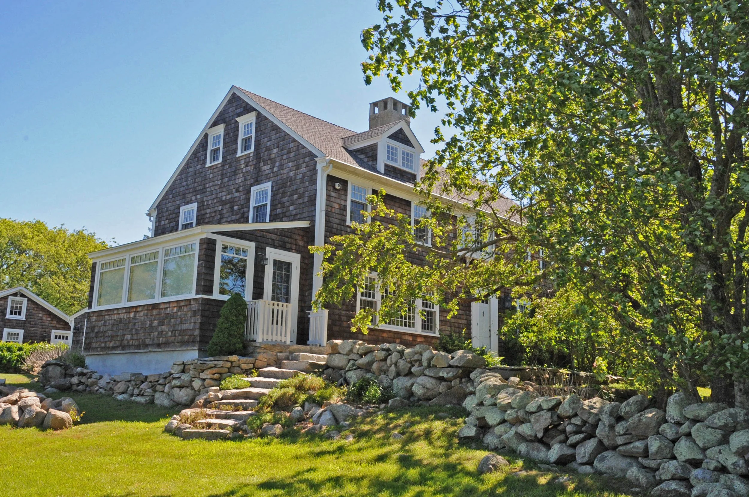
“This new bill would allow for three to three and a half floors instead of two,” Warner said. “We promote elevating above base flood elevation and the changes we made two years ago are working well. This bill isn’t adding any incentive or benefit for flood protection or protection against extreme weather. It does nothing to protect buildings from damage. We’d be building elevated mansions.”

Building and planning officials in South Kingstown, Westerly and Narragansett share similar concerns.

ecoRI News reached out to both CRMC and the Coastal Resources Center at the University of Rhode Island to get their take on the two bills. The Coastal Resources Center said it didn’t have anyone who could speak in depth about the bills. CRMC acknowledged the request, but didn’t supply a response.

The Conservation Law Foundation testified in April in support of the House bill.

Having the state go from using FEMA maps to CRMC maps to identify flood zones isn’t the problem the Rhode Island chapterof the American Planning Association (APARI) and others have with the bills. The concern is with other wording that has been slipped in and what that could mean for both the look and vulnerability of Rhode Island’s coast.

“This is a lousy bill that will give wealthy land owners the right to block off the shore,” said Weidman, co-chair of the APARI’s Legislative Committee. “Municipalities, and neighbors on the land side, are either going to face higher structures within flood hazard areas or are going to have to amend their zoning codes to reduce total heights in these areas.”

During the 2016 General Assembly session, the state’s definition of building height was debated by planners and builders and eventually amended. Among the major changes made was to allow any property in a flood hazard area to have its building height measured in a way that excludes up to 5 feet of freeboard. Measured in feet, freeboard compensates for flood heights and wave action by raising a building.

This change provided an incentive for property owners in flood hazard areas to go higher than 1 foot above base flood elevation, which is the current requirement in the state building code. It’s a good law and it’s working, Warner said.

The so-called “freeboard bill” passed without noticeable opposition from the Rhode Island planning community. Developers were happy, because, as freeboard height requirements increased in recent years, they said local height restrictions were limiting building.

The 2016 bill that was adopted, however, was much different than the original ask. Builders wanted more, Weidman said, and these two current bills resurrect some of that old language, including “for any property located in a flood hazard area, the building height shall be measured from the base flood elevation.”

Both Weidman and Warner recently told ecoRI News that the bills’ provision requiring that building height in flood hazard areas be measured from base flood elevation should be removed, as it was two years ago.

“This bill tells us how to measure height,” Warner said. “Each community should be free to decide what works best for it. This bill would increase the risk of wind damage to the larger buildings it would allow."

They both agreed that the current definition doesn’t need to be changed, and if it were to be by these bills, it would result in a dramatic change in how building height is defined and, without corresponding changes to a municipality’s building-height limits in coastal zones, would result in buildings with excessive height and bulk along Rhode Island’s coast.

Weidman is worried that the concerns of planners and builders will again be ignored by those on Smith Hill.

“There’s no pushback against the builders. We don’t have that standing in the General Assembly like they do,” she said. “We can’t get our bills out of committee. These bills are a complete giveaway to builders.”

Warner is concerned too few people, most notably municipal planners and building officials, understand the true impact these bills will have if they pass.

“There has been no real thought of the bills’ consequences,” he said. “There will be plenty of uproar when building permits are pulled and neighbors see the size of beachfront homes to be built.”

For instance, Warner noted that the maximum building height in Charlestown is 35 feet, plus up to 5 feet of freeboard in flood hazard areas. If the Rhode Island Builders Association-supported bills are passed, he said Charlestown could see buildings as high as 56 feet along the shore.

“It’s about economic development,” Weidman said. “It’s not about good growth, good land use, or good environmental practices. It’s all about economic development. Our land use needs to be done in a comprehensive manner, not caving to what builders want.”

Frank Carini is editor of ecoRI News.


David Smith: Icefishing and a flood's long-term effects


icefishing

Andy Murphy and his son James recently spent the day ice fishing on Chapman’s Pond, in Westerly, R.I. Since the floods of 2010, they say, the pond’s fish population has fallen. (David Smith/ecoRI News photos)

By DAVID SMITH/ecoRI News contributor

See EcoRI News


WESTERLY, R.I. — It takes a hearty soul to drill holes in ice, reach into a bucket of cold water numerous times to grab minnows to bait the hooks, set up five tippets and wait for the fish to bite.

Invariably, the wind chill is somewhere below the setting of your freezer and, unless you have a shelter, there is nowhere to hide.

But none of that deters Andy Murphy, 46, of Charlestown and his 19-year-old son, James. They have spent as many as 12 hours out on the ice waiting for a northern pike or largemouth bass worthy of bragging rights to swim by and grab their hooks. On this recent day, they started at 9:30 a.m. and figured to fish until about 3 p.m.

Sometimes the fish cooperate, and sometimes it’s just a day on the ice. On this day on Chapman’s Pond, the temperature was hovering around 37 degrees. And if not for the wind, the sun was shining enough to offer a bit of warmth. They were the only ones fishing.

The men spent the morning watching a bald eagle on the other side of the pond harass ducks and geese that bobbed in an open patch of water. They also saw a Canadian snow goose fly in with a flock of geese. The bird was all white with black-tip wings.

“He stuck out like a sore thumb,” James said. They did a quick search on their smart phone to verify the identification.

James said the secret to staying warm is layering of clothes. His father has a battery-operated heated sweatshirt and a Zippo hand-warmer tucked into his pocket.

They release all the fish they catch.

They release all the fish they catch.

Each of the men had five tippets, which is the limit allowed by state fishing rules. They release all the fish they catch. Nestled in the bucket on their sled next to an ice skimmer and a pair of pliers to pull hooks from the razor sharp teeth of pike is a scale to weigh the fish, and, of course, their cell-phone cameras. Sitting on the ice is a cooler with their lunch, which, in this case, was helping to keep it from freezing.

The men kept their eyes on the tippets. When a fish grabs the bait, the line runs out and a cog hits a wheel, which triggers the flag attached to a wire to flip up. There were no small, red flags waving in the breeze this morning.

“Patience,” Andy said. “We love to catch fish and beat our personal records. One good fish could turn your week around.”

Andy, who has been ice fishing for about 35 years, said his son has been ice fishing with him a long time. “Since I was old enough to walk,” James said.

This pond just off Route 91, however, is going through some hard times, with an abundance of weed growth and fewer pike.

“It’s been really dead,” Andy said.

“It’s been dead since 2010,” his son added. “The pond needs restocking. There had been some good ones.”

Andy said that before the flooding of March 2010 fish were prevalent in the pond; since, not so much.

“I bet they all went into the river,” he said.

There's a stream that flows out the northern end of Chapman’s Pond and into the Pawcatuck River. During that flood nearly five years ago, it was as if the pond and river were as one.

Andy said he would like to see Chapman’s become a catch-and-release only pond, and he would like it to be restocked so that other kids and fishermen can enjoy the resource.

“We pay for everything,” he said. “The state doesn’t do anything with the launch areas. We even pay for saltwater fishing licenses. They can’t stock the ocean. Why are we paying?”

The two never run out of shiners at Chapman’s Pond. They usually buy a dozen from Hope Valley Bait & Tackle for such an outing. If they’re fishing at Watchaug Pond, in Charlestown, they might buy five or six dozen because of the many species of fish, such as perch, crappie, pickeral and bass, that populate the pond.

“We wouldn’t bring a kid here (to Chapman’s),” Andy joked. “It would devastate him for the rest of his life.”

But still, there’s the tug of catching a trophy fish. That means father and son will be out on the ice whenever a pond is frozen. The other places they fish are Worden’s Pond, in South Kingstown, and 100 Acre Pond, in Kingston.

If it gets too cold, Andy said they have a two-man hunting shack they can use, which allows them to fire up a space heater. One time in New Hampshire it was minus 20 degrees.

“The stove was insulated and needed a blower to get the full potential of heat from it,” Andy said. “We didn’t have electricity for the blower.”

One of their most cherished pieces of equipment is a gas-powered auger that drills 10-inch holes in the ice. The hand-operated augers drill 6-inch holes. The bigger hole helps with pulling pike up through it, but when a monster pike hits the bait all bets are off whether it can even be maneuvered through a 10-inch hole.

“You’ve got to put in your time,” Andy said. “One day it will be phenomenal.”