URI

The great invasion

Digging for clams on Cape Cod

— Photo by Invertzoo

Text from article by Frank Carini in ecoRI news

A worldwide scientific intergovernmental group on biodiversity, which included a professor from the University of Rhode Island, provides evidence of the global spread and destruction caused by invasive alien species and recommends policy options to deal with the challenges of biological invasions.

The comprehensive report, released Sept. 4 by the Intergovernmental Science-Policy Platform on Biodiversity and Ecosystem Services for the United Nations, found the threat posed by invasive species introduced into new ecosystems is “enormous.”

In 2019, invasive species caused an estimated $423 billion in damages to nature, food sources, and human health. These alien invaders have also contributed to 60% of recorded animal and plant extinctions, and were the sole factor in 16% of extinctions, according to the report.

“This is the first global report on invasive alien species anywhere,” said Laura Meyerson, a URI professor in natural resources science and a contributing lead author on the report. “It’s truly an effort of scientists from around the world. The data touch on every world region, every biome and all major taxa — plants, vertebrates, invertebrates, micro-organisms, fungi.”

Invasive species pose to a threat biodiversity, ecosystem services, and human well-being. The report is designed to raise public awareness to “underpin action to mitigate the impacts of invasive alien species.”

To read the whole article, please hit this link.

Ocean stories

Bathymetry of the ocean floor showing the continental shelves and oceanic plateaus (red), the mid-ocean ridges (yellow-green) and the abyssal plains (blue to purple)

Some ocean life

Text from ecoRI.org

“Surrounded by sounds of calming music and videos of ocean habitats projected onto walls, University of Rhode Island professors and students discussed their experiences with the oceans in an immersive ‘Oceans Tell Stories Through People’ presentation last month at the University of Rhode Island’s Graduate School of Oceanography.

“The diverse storytellers shared narratives about their devotion to and reliance upon the sea during their Micronesian upbringing, as a Narragansett tribal elder living near Charlestown Beach, while researching marine ecology in the Bahamas, and in their work in the muddy Ecuadorian mangroves.

“Juxtaposed against the tranquility of the presentation, however, the distressingly common undercurrents of racism, colonialism, and exclusion from our oceans conflated their stories.”

To read the full article, please hit this link.

Aquaculture and waterfowl

URI graduate student Tori Mezebish holds a black duck she tagged as part of her research on the interactions between waterfowl and aquaculture facilities. (Courtesy photo)

From ecoRI News (ecori.org)

As aquaculture operations expand in Narragansett Bay and Rhode Island’s salt ponds, questions have arisen about how ducks and geese are impacted by the facilities. To begin to answer these questions, a University of Rhode Island doctoral student is tracking the movements of local waterfowl.

“There haven’t been any Rhode Island studies yet, but studies on the Pacific Coast have found issues with diving ducks getting tangled up in netting used by aquaculture, and birds that have been deterred from areas that might otherwise be good habitat because of the activities of aquaculture operations,” said Tori Mezebish, a native of Maryland who is collaborating on the project with URI professors Peter Paton and Scott McWilliams and officials from the Rhode Island Department of Environmental Management.

She noted previous studies have also observed sea ducks such as eiders and scoters, which feed on mollusks, preying on oysters and other shellfish being grown by aquaculturists.

“There’s also been some positive associations, like ducks and geese eating some of the aquatic vegetation that accumulates on the cages,” Mezebish said. “It’s a mixed bag of how the birds might interact with aquaculture.”

Last winter, Mezebish attached transmitters to 30 black ducks and 30 brant, a species of goose that lives in salt water. This winter she will deploy an additional 30 transmitters on common goldeneyes, a diving duck. All three species are common during winter in Narragansett Bay, the state’s salt ponds, and adjacent salt marshes.

Most of the brant have returned from their breeding grounds in the Arctic, and several of them spend every day with dozens of other brant on the lawn at Colt State Park in Bristol. Others are spending most of their time in the upper bay and Providence River. The black ducks are just beginning to return to the area from Maine and southern Canada, and the early arrivals have been tracked to the salt ponds and the Galilee area.

Mezebish is tracking the movements of each bird using a GPS unit on their transmitters to see how much time they spend near aquaculture facilities. She is also observing the birds in the field to validate the GPS data and see what the birds are doing around the shellfish farms.

“The goal is to understand what is important to these species outside of the aquaculture facilities,” she said. “Maybe brant need shallow areas with submerged vegetation, so that may not be the best place to put an aquaculture lease.”

In addition to Mezebish’s study, URI postdoctoral researcher Martina Müller is conducting land-based surveys throughout the year to see what other kinds of birds may be interacting with aquaculture facilities.

“Ultimately, we want to provide recommendations about the good and not so good places for aquaculture leases to be placed,” said Mezebish, who became interested in waterfowl research as an intern at the Pawtuxet Wildlife Research Center in Maryland, where she hand-reared ducklings used in the center’s research activities.

When the project is complete, Mezebish hopes to use the study as a springboard to study related questions about other conflicts and interactions between waterfowl and humans.

Frank Carini: When you let the sands shift naturally

Dunes on Napatree Point

Dunes on Napatree Point

WESTERLY, R.I.

In late October 2012, about a day after Superstorm Sandy’s initial surge battered much of southern New England’s coast, especially its open-ocean shoreline, Janice Sassi navigated her way through a parking lot here filled with “mountains of mud” to find a “moonscape.”

“The dunes were completely flat,” recalled Sassi, manager of the 86-acre Napatree Point Conservation Area. “I thought it was done. It looked like one big beach.”

Sandy had ripped chunks of beachgrass from sections, and one area was forced back some 30 feet. At that moment and for days after, Sassi was concerned about Napatree Point’s future.

Her friend Peter August, a now-retired University of Rhode Island professor and a Napatree Point science adviser, put her racing mind at ease. The former director of URI’s Coastal Institute told her the resilient peninsula that offers sweeping views of Little Narragansett Bay, Block Island Sound, and New York’s Fishers Island would be fine. He reminded her that Napatree Point had previously survived one of the most destructive and powerful hurricanes in recorded history.

The hurricane of 1938, also known as the “Great New England Hurricane,” smashed the peninsula’s 39 2- and 3-story houses that stood just a few feet from the churned-up fury of the Atlantic Ocean. The 3- to 4-foot-high wall in front of those summer homes did nothing to prevent their destruction.

Storm waves broke over roofs and plowed “through the cement seawall as if it were transparent,” R.A. Scotti wrote in her 2003 book, Sudden Sea: The Great Hurricane of 1938.

“If you build on a barrier beach, you are toying with nature,” she wrote.

On the other side of the Napatree Point peninsula, most if not all of the private docks that extended into Little Narragansett Bay were reduced to kindling. Some residents waited out the 100-year storm in the remains of decommissioned Fort Mansfield. Fifteen people died.

The historic ’38 storm, much more so than Superstorm Sandy nine years ago, pummeled the 1.5-mile-long, sand-swept peninsula that curves away from the affluent village of Watch Hill. It severed the connection to Sandy Point, now a mile-long island shared by Rhode Island and Connecticut. In the eight decades since Sandy Point was left afloat, the island has drifted one and a half miles to the north.

More than a century earlier, Napatree Point, which was then densely forested — its name reportedly derives from nap or nape (neck) of trees — was significantly altered by another hurricane. The Great September Gale of 1815 “wiped it clean” and no tree has grown there since, according to Scotti’s book.

Following the hurricane of 1815, Napatree Point was significantly developed, and saw the construction of a boarding house and a hotel. By the end of the century, construction of Fort Mansfield had begun.

Though Sassi, then less than three years into her job after a career in law enforcement, was initially skeptical of August’s reassurances that her beloved Napatree Point would rebound, she’s thankful it did. She said it took about five years for the conservation area to completely repair itself. The beachgrass regrew, and the dunes regained their elevation.

Napatree Point was able to heal itself because humans have given it room to breathe. After the ’38 hurricane, one of the most financially destructive storms on record, developers looking to rebuild the summer cottages and construct other structures were rebuffed.

With no roads, homes, and hardened structures obstructing Mother Nature, Napatree Point has been allowed to change with the times. August noted that the barrier beach has the space to continually wash back over itself.

“It doesn’t erode away. It just moves,” said August, who founded URI’s Environmental Data Center three decades ago. “Napatree Point was 80 acres when the hurricane of ’38 struck; it’s 80 acres now, just in a different place. Napatree Point will always be here. It rolls with the punches. It gets changed but still exists.”

The Hope Valley resident said the geology of Napatree Point is a perfect example of how a barrier dune ecosystem works naturally. He explained that when Napatree Point is hit by big storms, such as the Great New England Hurricane or Superstorm Sandy, and wave action and tidal surge punch through the dunes, it creates wash-over fans on the backside, meaning the position of the peninsula’s dunes change; they aren’t lost.

“They’re rolling over themselves and they can do that because we’re letting the sand go where the sand wants to go,” August said.

Napatree Point is owned, managed and protected by a partnership of different interests: the Watch Hill Fire District, the Watch Hill Conservancy, which employs Sassi, the Town of Westerly, the state, and a few private landowners. Conservation easements protect it from future development.

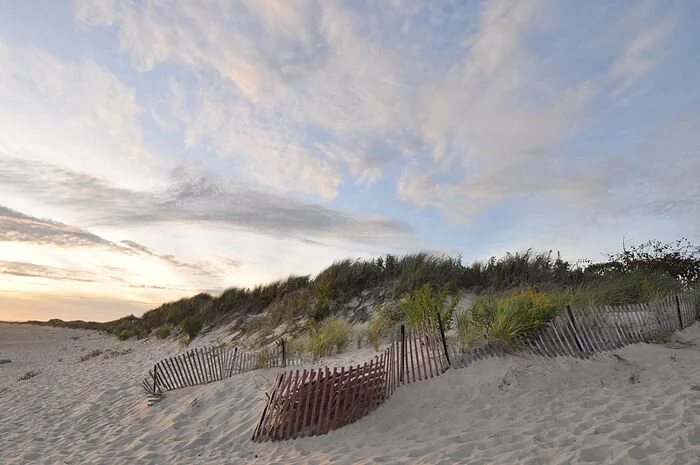
In the summer, this slender strip of land — the average width is 517 feet — at the mouth of Little Narragansett Bay, where the Pawcatuck River empties into Block Island Sound, is overrun with tourists, boaters, beachgoers, hikers, anglers and nature observers. Finding a scrap of beach can be difficult, and some areas are roped off for important visitors, most notably piping plovers and American oystercatchers, both of which nest in the sand.

Sassi is thrilled that Napatree Point is so popular, but all the human visitors have an accumulating impact on the peninsula’s delicate dune system. The West Warwick, R.I., resident noted that the fact there is no development makes it easier for the small peninsula to defend itself from a changing climate and human intrusion.

The conservation area, however, isn’t immune to sea-level rise and other stressors associated with the climate crisis. About three years ago, Sassi and August began noticing that the entrance to Napatree Point, through a large parking lot off Bay Street that is lined with boutique shops and a mix of culinary options, began to flood during extremely high tides.

It’s now beginning to flood even during normal high tides. As sea levels rise and more frequent flooding occurs, access to the peninsula, at least via land, will become more and more restricted unless something is done. August said plans are underway to elevate the entrance, which laps up against Watch Hill Harbor.

Napatree Point is a barrier beach that has been shaped and reshaped by storms, sometimes profoundly, as was the case 206 years ago, 83 years ago, and nine years ago. The peninsula is composed of more sand than soil and its shoreline is worked upon daily by ocean waves and the tide. Like most barrier beaches, especially those with no human-made structures, Napatree Point is constantly in a state of flux. Since 1939, it has shifted north, toward Little Narragansett Bay, some 200 feet, according to mapping by the Coastal Resources Management Council.

The peninsula, however, is much more than a summer destination and a birdwatcher’s paradise. It’s also a habitat provider and a storm protector.

This fragile yet pliable barrier beach helps protect Westerly’s mainland. And to help protect Napatree Point’s dynamic ecosystem — and, thus, tourist-friendly Watch Hill — from storm surge, coastal erosion, and human visitors, a number of restoration projects have been undertaken.

During the past dozen years, some 4,000 native plants, such as seaside goldenrod, beach plum, swamp milkweed and groundseltree, have been added to help anchor Napatree Point’s shifting sands — their dense root mats keep erosion in check — and to attract pollinators.

Split-rail fences have been erected and signs posted to keep visitors and their wheeled coolers from making their own paths from the peninsula’s protected side to its open-ocean side. At one point several years ago, 50 crossover paths had been plodded through Napatree Point’s dunes and vegetation. Dinghies and Zodiacs land on the Little Narragansett Bay/Watch Hill Harbor side, before their occupants traverse the peninsula to the Atlantic Ocean side, where they lie in the sun, swim, and bodysurf.\

This tireless restoration work piloted by Sassi, August, Hope Leeson, Bryan Oakley and others has made Napatree Point a national model for stewardship, an important distinction since the area caters to an abundance of life, including mussel beds, bats, minks, foxes, deer, monarch butterflies, and a plethora of birds.

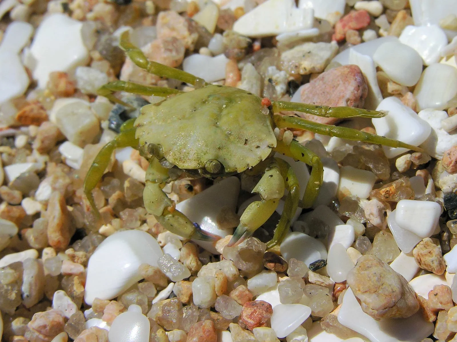
Off its coast are some of the biggest and healthiest eelgrass beds in Rhode Island waters. These vital marine ecosystems provide foraging areas and shelter to young fish and invertebrates, spawning surfaces for sea life, and food for migratory waterfowl. Gray and harbor seals hang out on the open-ocean side of the peninsula. In the winter, rafts of sea ducks are a common sight in the waters off the peninsula.

The Audubon Society has recognized Napatree Point as a globally important bird area. Veteran Rhode Island birder Rey Larsen has identified more than 300 different species of birds on the sandy, wind-swept peninsula.

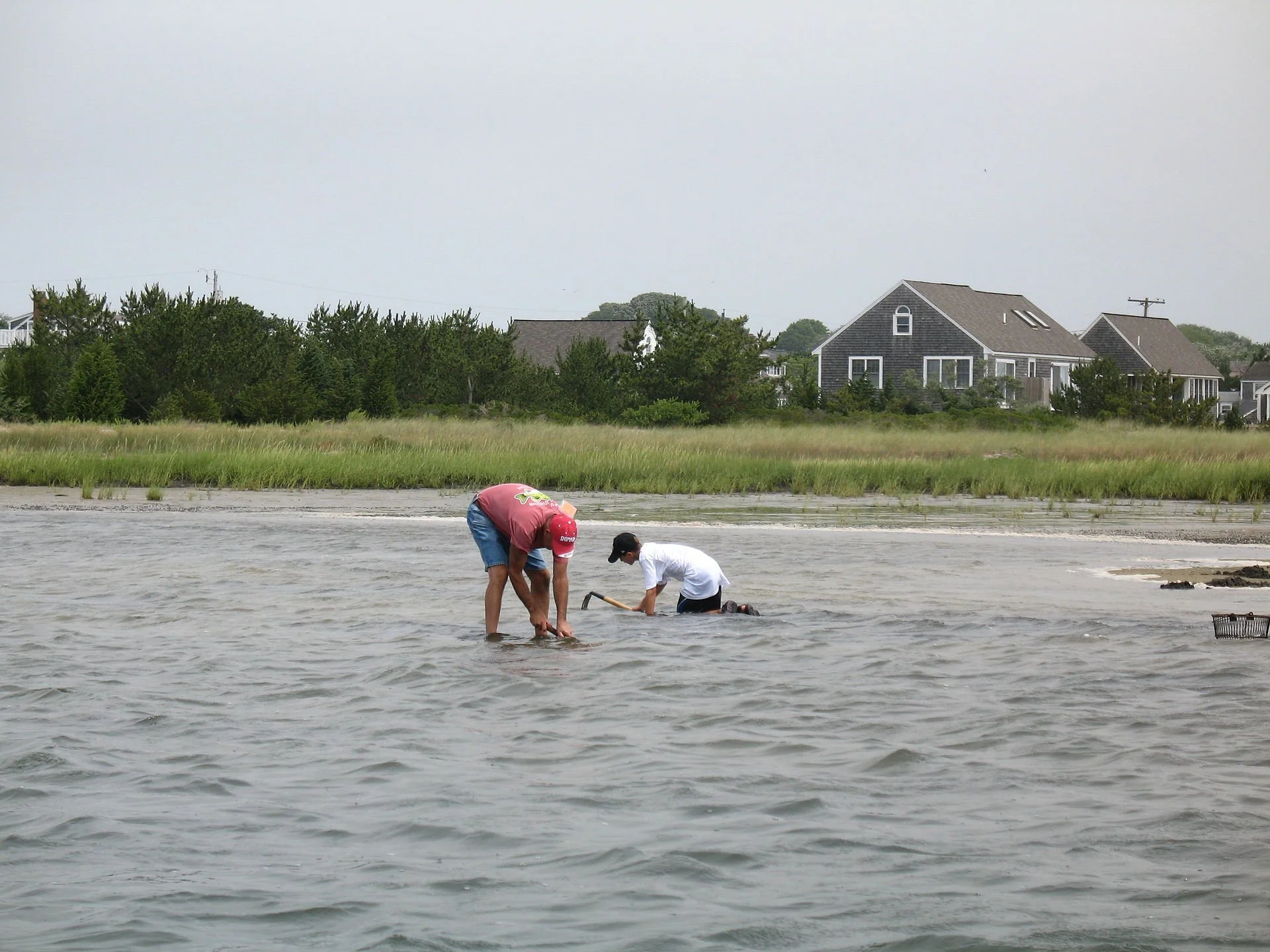
The Napatree Point lagoon, about 3.5 feet deep in the middle, is home to a half-dozen different kinds of fish, including the American eel. It’s also an important horseshoe-crab nursery. The entrance to the 10-acre lagoon, from Little Narragansett Bay, is the peninsula’s most rapidly changing part, according to August. He said the entrance to the lagoon has moved a few times during the past decade alone.

Napatree Point, unlike much of Rhode Island’s built-up coastline, is better positioned to handle the climate crisis because humans are allowing its sands to shift naturally.

“The most important thing we can do is get people excited about Napatree Point so they want to protect it,” Sassi said.

For a wealth of science, stewardship, and monitoring information about the Napatree Point Conservation Area, click here.

Frank Carini is editor of ecoRI News.

Watch Hill and Watch Hill Cove from the eastern end of Napatree Point

Watch Hill and Watch Hill Cove from the eastern end of Napatree Point


URI creating computer models to assess how environmental change affects the ecosystem of Narragansett Bay

The Charles Blaskowitz Chart of Narragansett Bay published July 22, 1777 at Charing Cross, London

The Charles Blaskowitz Chart of Narragansett Bay published July 22, 1777 at Charing Cross, London

From ecoRI News

A team of scientists at the University of Rhode Island is creating a series of computer models of the food web of Narragansett Bay to simulate how the ecosystem will respond to changes in environmental conditions and human uses. The models will be used to predict how fish abundance will change as water temperatures rise, nutrient inputs vary, and fishing pressure fluctuates.

“A model like this allows you to test things and anticipate changes before they happen in the real ecosystem,” said Maggie Heinichen, a graduate student at the URI Graduate School of Oceanography. “You want to be able to prepare for changes that are likely to happen, so the model provides a starting point to ask questions and see what might happen if different actions are taken.”

Heinichen and fellow graduate student Annie Innes-Gold collaborated on the project with Jeremy Collie, a professor of oceanography, and Austin Humphries, an associate professor of fisheries. They used a wide variety of data collected about the abundance of marine organisms in Narragansett Bay, including life history information on nearly every species of fish that visits the area, and data about environmental conditions.

Their research was published in November in the journal Marine Ecology Progress Series. Additional co-authors on the paper are Corinne Truesdale at the Rhode Island Department of Environmental Management (DEM) and former URI postdoctoral researcher Kelvin Gorospe.

“We built one model to represent the bay in the mid-1990s, the beginning point of the project,” Innes-Gold said, “and another one that represents the current state of the bay. That allowed us to predict how the biomass of fish in the bay would change from a historical point to the present day and see how accurate the model was in its predictions.”

The model correctly predicted whether each group of fish or fished invertebrates would increase or decrease.

The students are now expanding the model using various fishery management scenarios and expected temperature changes to assess its outcomes.

“What if there was no more fishing of a particular species, for instance, or double the fishing? How would that affect the rest of the ecosystem?” Innes-Gold asked. “I’m also incorporating a human behavior model to represent the recreational fishery in Narragansett Bay. I’ve run trials on whether unsuccessful fishing trips affect whether fishermen will come back to fish later, and how that affects the biomass of fish in the bay.”

Heinichen is incorporating the temperature tolerance of various fish species into the model, as well as other data related to how fish behave in warmer water.

“Metabolism rates and consumption rates increase as temperatures go up, and this affects the efficiency of energy transfer through the food web,” she said. “If a fish eats more because it’s warmer, that affects the total predation that another species is subjected to. And if metabolism increases as waters warm, more energy is used by the fish just existing rather than being available to turn it into growth or reproduction.”

In addition, an undergraduate at Brown University, Orly Mansbach, is using the model to see how fish biomass changes as aquaculture activity varies. If twice as many oysters are farmed, for example, how might that impact the rest of the ecosystem?

The URI graduate students said that the models are designed so they can be tweaked slightly with the addition of new data to enable users to answer almost any question posed about the Narragansett Bay food web. They have already met with DEM fisheries managers to discuss how the state agency might apply the model to questions it is investigating.

“We’re making the model open access, so if someone wants to use it for some question yet to be determined, they will have the model framework to use in their own way,” Heinichen said. “We don’t know all the questions everyone has, so we’ve made sure anyone who comes across the model can apply it to their own questions.”

The Narragansett Bay food web model is a project of the Rhode Island Consortium for Coastal Ecology, Assessment, Innovation and Modeling, which is funded by the National Science Foundation.

Salt water is contaminating wells in Rhode Island as sea level rises

Saltwater_Intrusion.gif

From ecoRI News

Drinking water wells at homes along the Rhode Island coastline are being contaminated by an intrusion of salt water, and as sea levels rise and storm surge increases as a result of the changing climate, many more wells are likely to be at risk.

To address this situation, a team of University of Rhode Island researchers is conducting a series of geophysical tests to determine the extent of the problem.

“Salt water cannot be used for crop irrigation, it can’t be consumed by people, so this is a serious problem for people in communities that depend on freshwater groundwater,” said Soni Pradhanang, associate professor in the URI Department of Geosciences and the leader of the project. “We know there are many wells in close proximity to the coast that have saline water, and many others are vulnerable. Our goal is to document how far inland the salt water may travel and how long it stays saline.”

Salt water can find its way into well water in several ways, according to Pradhanang. It can flow into the well from above after running along the surface of the land, for instance, or it could be pushed into the aquifer from below. Sometimes it recedes on its own at the conclusion of a storm, while other times it remains a permanent problem.

Pradhanang and graduate student Jeeban Panthi are focusing their efforts along the edge of the salt ponds in Charlestown and South Kingstown, where the problem appears to be the most severe.

Since salt water is denser than fresh water, it typically settles below. So the scientists are using ground-penetrating radar and electrical resistivity tests — equipment loaned from the U.S. Geological Survey and U.S. Department of Agriculture — to map the depth of the saltwater/freshwater interface.

“In coastal areas, there is always salt water beneath the fresh water in the aquifer, but the question is, how deep is the freshwater lens sitting on top of the salt water,” said Panthi, who also collaborates with URI professor Thomas Boving. “We want to know the dynamics of that interface.”

The URI researchers plan to drill two deep wells this month to study the geology of the area and the chemistry of the groundwater to verify the data collected in their geophysical tests.

The first tests were conducted in the summer of 2019, and a second series was completed this fall after being delayed by the pandemic. Final tests will be conducted this spring when groundwater levels should be at their peak.

“The groundwater level was at its lowest point in 10 years this summer because of the drought,” said Panthi, a native of Nepal who studied mountain hydrology before coming to URI. “That will be a good comparison against what we expect will be high levels in April and May.”

Panthi has collected well-water samples from nearly two dozen residences for analysis. One of the contaminated wells is a mile inland from Ninigret Pond, in Charlestown.

Ninigret Pond, in Charlestown, R.I.

Ninigret Pond, in Charlestown, R.I.

“A homeowner had a deep well drilled for a new house and it ended up with extremely saline water,” Pradhanang said. “Deep wells close to the salt ponds or the coast are more likely to have saltwater intrusion than shallow wells, though shallow wells can also have problems if they become inundated with salt water.”

Another URI graduate student, Mamoon Ismail, is developing a model to simulate saltwater intrusion into drinking water wells based on the changing pattern of precipitation and the potential for extreme storms. They hope to be able to predict how far inland salt water will intrude following a Category 1 hurricane compared to a Category 2 storm, for instance.

This research is being funded by the Rhode Island office of the U.S. Department of Housing and Urban Development.

880px-Salt_water_intrusion_wikipedia2.png


Dooley a great URI president

The Chester H. Kirk Center for Advanced Technology at the University of Rhode Island main campus, in Kingston— Photo by Kenneth C. Zirkel

The Chester H. Kirk Center for Advanced Technology at the University of Rhode Island main campus, in Kingston

— Photo by Kenneth C. Zirkel

David Dooley has been a great president of the University of Rhode Island.  He’ll retire in June 2021.

He’s helped bring in the strongest  and most diverse student body and faculty the university has ever had, who have done widely  recognized research in URI’s nationally, and in some cases internationally, known centers of excellence. He’s overseen construction of functionally superb and architecturally important new buildings while improving the aesthetics of the already bucolic campus.  He’s been  very adept at raising money to steadily raise the university’s stature.

What makes the achievements of Mr. Dooley, a chemist by training, all the more impressive is that his tenure started in July 2009, a very difficult time because of the Great Recession. He’ll face new and familiar issues as he helps guide the university and his anointed successor through the next year, which is bound to be very difficult one for American academia.  The university is lucky that he’ll be in charge as this crisis rolls on

Climate change complicating global marine governance

440px-Clouds_over_the_Atlantic_Ocean.jpg

From ecoRI News (ecori.org)

KINGSTON, R.I.

The international governance of marine areas beyond national jurisdictions is an issue of growing importance as temperatures increase, sea levels rise, islands become submerged and artificial islands are built. As territorial boundaries change, conflicts are arising that no one envisioned in the 1970s and ’80s when the United Nations Convention on the Law of the Sea was negotiated.

It’s a complex subject to which Elizabeth Mendenhall is paying close attention. The assistant professor of marine affairs and political science at the University of Rhode Island said the United States could play a crucial role in how the Law of the Sea is interpreted under changing circumstances. But the United States is one of very few nations that hasn’t ratified the agreement, and it doesn’t appear likely to do so any time soon.

“The Law of the Sea is a big agreement that still prevails as the legal framework for managing the ocean, but at the time it was negotiated we didn’t know anything about global warming, ocean acidification, or sea-level rise,” said Mendenhall, a native of Kansas who joined the URI faculty in 2017. “How did anyone think it would work when it was negotiated before we really understood the ocean we were trying to govern?”

Mendenhall studies how international law and international institutions succeed or fail as the global environment changes.

“As I see it, we created this regime of norms and principles of governing the oceans, but it’s a static law in a changing world,” she said. “How can that law be built in such a way that it’s flexible and adaptive? And if it’s built that way, how can we make sure those features are being used? Right now, we’re being reactive to the changes taking place, and we’re reacting very slowly.”

A major focus of Mendenhall’s work is examining the legal implications of sea-level rise on the 200-nautical-mile exclusive economic zones of nations when islands become submerged and coastlines change. When an island disappears, a nation may lose economic control of the maritime territory around the island.

“What happens legally as sea levels rise impacts our ability to achieve peace, stability, and sustainability in the century to come,” she said during a TEDx Talk at URI last February.

The question becomes even more complex now that technology enables nations to build artificial islands, which China and other nations are doing in the South China Sea, either to expand their control over a wider swath of the sea or to defend their legal claims.

“China doesn’t legally get to claim that maritime space,” Mendenhall said. “I believe the U.S. should better utilize legal arguments to challenge China’s maritime claims. We could easily make a positive contribution to the interpretation of the Law of the Sea by making declarations and getting other nations to make similar declarations that territorial claims around artificial islands should not be respected.”

Mendenhall is also closely following U.N. negotiations for a treaty to address how biodiversity is managed beyond national jurisdictions in the middle of the oceans. She and a group of colleagues attend all of the negotiations in New York City and interview the delegates.

“The hot-button issue is the question of marine genetic resources,” she said. “There are rules for patenting genetic sequences on land and in coastal waters, but there are no rules that apply to the middle of the ocean. If you go to a hydrothermal vent in the middle of the ocean and sequence the DNA of a creature living there, can you patent it? Previous agreements say that all nations control those resources together. So who gets the profits? That has taken up a lot of conversational space.”

Mendenhall is also being encouraged to get into the middle of the public debate about the growing problem of plastic debris in the oceans. She has already published a paper that catalogs scientific research about the topic and lists questions in need of answers before effective policies can be made.

While the media has reported extensively on the effort by The Ocean Cleanup to create a technology that can autonomously extract plastics from the oceans, Mendenhall believes the project is the wrong approach.

“That approach is all about cleaning up at the end of the chain, rather than fixing the problem at its beginning,” she said. “First, it’s a nonprofit funded by donations, which is allowing governments to say that the nonprofit world is handling the problem so they don’t have to do anything about it. I also fear it will be a green-washing for the plastics producers so they don’t have to address their role in the problem.

“It’s a real challenge internationally because the source of the problem is in sovereign national territory while most of the consequences are in shared space in the middle of the ocean. It’s hard to come up with an international agreement that tells you what you have to do domestically.”

The URI professor hopes to address other issues in what she calls “the global commons” as well, including territorial disputes in the Arctic.


A new tuna acquaculture industry in R.I.?

Schooling yellowfin tuna.

Schooling yellowfin tuna.

From Robert Whitcomb’s “Digital Diary,’’ in GoLocal24.com

All hail the University of Rhode Island’s planned

, whose mission is to create a sustainable yellowfin tuna aquaculture industry. The project includes a 125,000-gallon tank (which I’ve visited) at URI’s Graduate School of Oceanography, on the shore in Narragansett. The tank now has about a dozen tuna swimming in it. Do fish suffer from claustrophobia?

This is still entirely a research program, focused on studying tuna reproduction. But the idea is to eventually create an important industry, with perhaps some of it based in our region. Presumably other finfish species will be studied and, ultimately, farmed because of URI research. This is the sort of project in which the Ocean State should have a strong comparative advantage. URI continues to do great things.

Making URI bike-friendlier

By the URI Quad.

By the URI Quad.

From Robert Whitcomb's "Digital Diary,'' at GoLocal24.com:


Kudos to the University of Rhode Island for working to make the Kingston campus better for bicyclists with, for example, plans to rebuild Flagg Road and Upper College Road into what a URI master plan calls “complete streets’’ that would include bike lanes on both sides. There’s also the idea of connecting URI to the William C. O’Neill Bike Path, reported the Independent newspaper. The program is officially called URI’s Transportation and Parking Master Plan.

The URI campus is mostly lovely, a good reason in itself to lay out more bike paths. And many students can’t afford cars.

The master plan, overseen by Christopher McMahan,  the university’s much admired architect and director of capital planning and design, also envisions further increases in bus service provided by the Rhode Island Public Transit Authority.

These moves will make the campus more attractive, improve its natural environment, reduce the pressure to add more parking and make it easier for students and others to avoid driving. URI has made much progress in recent years in raising its academic and aesthetic stature. The transportation improvements are an important part of that.


Of class and charity


By ROBERT WHITCOMB

Philanthropic contributions by very rich people get a lot of attention. An example around here is Thomas Ryan, a former head of CVS who recently gave $15 million to the University of Rhode Island for a brain-science center to be named after his parents.

Besides the satisfactions of giving per se and the plaudits of the general public, gifts are sometimes meant to show other rich people how successful the givers are. This explains why so much new money rushes into already very rich “nonprofit” institutions, such as Ivy League colleges and big art museums. Wouldn’t giving a pile to, say, a community college serving poor people do more for society than adding yet more to Harvard’s $31 billion endowment?

And this is not the age of the anonymous contribution. Of course, nonprofits, besides appealing to altruism and ego, know that publicizing the names of the donors may encourage an arms race of giving by other rich people.

Anyway, URI alumnus Ryan commendably gave to a local and grossly underfunded public institution. A few years back, the arena at URI was named after him as a result of gifts by him and CVS. In his last 14 months as CEO, he made $124 million, reported Dow Jones. Of course, if the very rich paid a tad more in taxes, then public institutions could more often build such public facilities out of public money and not always be selling “naming opportunities.”

Large public companies’ senior execs have rarely been romantic altruists. But there’s no doubt that they have adjusted their missions, and sense of civic duty, in the past 30 or so years via tax and other legal changes engineered by their lobbyists.

Most of these companies used to consider themselves as having a fairly wide range of stakeholders — not just senior executives and other big shareholders but nonexecutive employees and the communities within which the companies operated. The idea was that the long-term success of the companies would depend on addressing the welfare of all constituencies.

Now the aim above all is to maximize and speed compensation for senior execs, on which, because of lobbyists’ success in creating tax dodges, many pay remarkably little tax, considering their wealth. Investment gains via stock options, etc., are much tax-favored over wages. (The quickest way to maximize their personal profits is to lay off and/or cut the compensation of lower-level employees.) This explains in part, along with globalization, computerization, automation and the loss of local ownership in many places — laying off your neighbors is tough — explains some of the woes of the middle class the past 30 years or so.

Then there’s American feudalism. The Walton family has a fortune of about $100 billion. They have so much money, in part, because their company pays their employees so little. Some Walmart stores have food drives for impoverished Walmart employees.

The holders of current and future dynastic wealth arrange through tricky trusts (including the creative use of charities) and other perfectly legal mechanisms to pay remarkably little or no estate or gift taxes and thus help ensure the self-perpetuation of power and wealth for their heirs. Readers should read about the wonders of “donor-advised funds” for charities — also a cash cow for financial firms because of the fees — and “charitable lead annuity trusts,” used to boost dynastic wealth by avoiding taxes.

The usual structure for these things is the "foundation,'' which can sometimes be more of  creature for perpetuating private dynastic wealth and power than a device for good works.

Some more reasons that the government is broke.

Among other benefits, this dynastic wealth gives favored families access to the fanciest schools with the best-connected faculty and students, which, in turn, reinforces the vast advantage that the lucky heirs already have. Thus there’s less social mobility in America than in most of its developed world competitors.

The public might want to at least consider whether society would be better off if the very rich shared a tad more of their wealth further upstream rather than through the charities they create to do good works, glorify their names and/or avoid paying taxes that pay for public services such as URI.

***

A good thing about this sometimes gray, sometimes golden time of the year is that you don’t have to weed for a while and it cleans out the mosquitoes. No wonder farmers tend to like November and December. They get a rest. Too bad the holidays have to ruin it.

***

Everyone understandably bemoans Rhode Island’s jobless rate of 9.2 percent. But bear in mind that the state’s tininess and industrial history skew those numbers. If you spun off eastern Connecticut, parts of Berkshire County, Mass., or upstate New York into separate states, they’d have similar rates. Still, Rhode Island should have done a lot more to capitalize on its location, ports and fabulous design community.

Robert Whitcomb (rwhitcomb4@cox.net; rwhitcomb51@gmail.com; newenglanddiary.com) is a former editor of The Providence Journal's Commentary pages, where this column started, and a Providence-based editor and writer.